In this Adventure 3-pack we focus on three plane crashes that occurred during the 1950's when aircraft technology - including navigation and
Air Traffic Control struggled to keep up with the growing air travel industry.
-
The Crash of TWA Flight 260.
-
At 7:05 a.m. on February 19, 1955 TWA Flight 260 crashed into the Sandia Mountains within minutes after takeoff from Albuquerque on what should have been a
short flight to Santa Fe. This crash resulted in a controversial ruling of pilot error that was later overturned when a pilot proved that the compass
used was prone to error. Additionally there was controversy regarding weather conditions - the report claiming that the weather should have been clear enough
for the pilots to see the mountain that was clearly visible to ground crews at the airport. Pilots disagreed with this as well, and found that weather
conditions over the Sandia Mountains were often quite different than on the ground. One pilot, confronted with airport ground crew reports of clear conditions, retorted
"We fly airplanes not airports". (Recommended book The Crash of TWA Flight 260).
-
[Flight# AP61 (KABQ-KSAF)] Complete the ill-fated flight to KSAF(KABQ - KSAF)
-
Aircraft: Martin 4-0-4 (recommended)
-
Weather: Your choice, but the actual flight was in partly cloudy conditions
-
Time: Daytime.
-
Scenario:
Flight# AP61 recreates the flight of TWA 260, only this time hopefully you will complete the flight successfully. Start at KABQ, climb to cruise
altitude of 9000 feet and follow the ABQ VOR 10 radial (victor 19 airway) to Aden intersection where you pick up the SAF VOR 240 radial. Follow that to KSAF.
Note: It has been brought to my attention that ADEN doesn't exist on modern charts, so I might suggest V611 from KABQ to KSAF (ABQ - NODME -
NELGE - LIYIR - SAF). This looks approximately like the old standard flight path depicted in the book. Alternatively, if your plane is
equipped with two nav radios, you can find the old ADEN intersection by tuning nav1 into ABQ and flying out on the 10 with nav2
tuned into SAF VOR and set to the 240 radial. As you track outbound on ABQ 10 you'll see your nav2 needle begin to move until it's centered.
Provided nav2 is set to SAF and the 240 radial, when the nav2 needle is centered, you're crossing the 240 radial and have reached ADEN.
At this point select Nav2 as your autopilot source or change nav1 to the nav 2 settings so your plane begins to track the SAF 240 radial.
-
[Flight# AP62 (KABQ-KABQ)] Find the crash Site (KABQ - Crash Site - KABQ)
-
Aircraft: Helicopter (recommended)
-
Weather: Your choice, but relatively clear will help find the wreck site.
-
Scenario:
On Flight# AP62 we will seek out the crash site of TWA 260. You will find the wreckage on the Sandia Mountain Range approximately along the 50 radial from ABQ VOR.
Note, the terrain there is not suited for landing even a bush plane, so either view the wreck site from the air or try a helicopter flight that might allow a landing
on a flat area nearby. After locating the crash site, return to KABQ to complete part-I of this adventure pack.
-
The Mysterious Disappearance of Northwest Flight 2501
-
Around midnight on June 23, 1950, Northwest Flight 2501, a DC-4 with 58 persons aboard, crashed into Lake Michigan.
The DC-4 was en route to Minneapolis (KMSP) from New York's La Guardia airport (KLGA) when it flew headlong into a severe thunderstorm while crossing
the open water. To this day the plane's final resting place remains a mystery although human remains and crash debris did wash up on the beaches of West Michigan,
and other debris was found out on the lake. (Recommended book Fatal Crossing).
-
[Flight# AP63 (KLGA-KMSP)] Complete the ill-fated flight to KMSP(KLGA-KMSP)
-
Aircraft: Your choice - but recommend freeware DC-4
-
Weather: Set severe thunderstorm over Lake Michigan.
-
Time: Night (2035 Hrs local New York time).
-
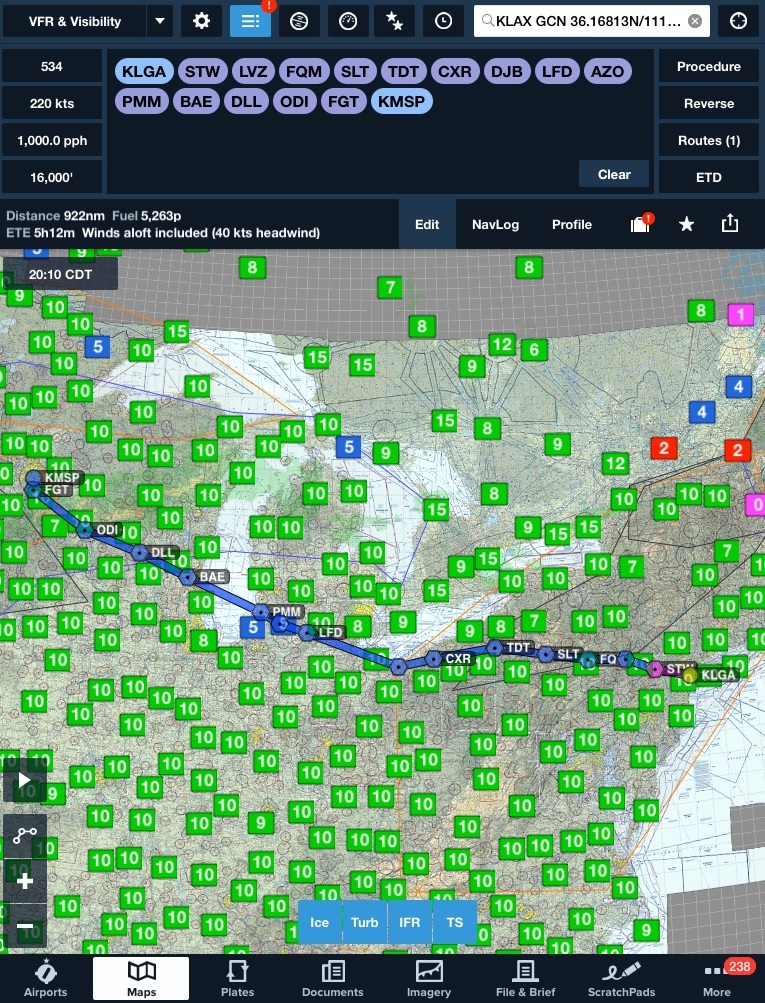
Scenario: In Part-I of this second adventure we complete a long flight (about 4-5 hours) from KLGA to KMSP and fly through the thunderstorm over
Lake Michigan. The cruise altitude is from 3500 to 6000 so you should be able to see some sights out your window (although it will be nighttime).
Feel free to break this flight into several segments and land at various stops along the way. Just use the identical flight number (AP63) for all
the flight segments from KLGA to KMSP. If you really want to increase realism - fly VOR to VOR using the Nav radios. For approximate altitudes of this flight, records indicate that Flight 2501 flew to cruise altitude of
6000 feet after leaving New York. As 2501 Approached Cleveland (VOR DJB) they requested and received permission from ATC to descend to 4000 ft. to stay below
clouds of the approaching storm. Over Litchfield, Michigan (VOR LFD) 2501 was ordered down to a mere 3500 feet to avoid conflict with a Lockheed Lodestar in
the vicinity. It was at this altitude that 2501 crossed Lake Michigan into the face of the approaching storm. This VOR to VOR flight plan approximates
the route flown by 2501.
-
Locate Debris Site of Flight 2501 on Lake Michigan [Flight# AP64 (KBIV-KBIV]
(KBIV-Crash Site-KBIV)
-
Aircraft: Amphibious
-
Weather: Your discretion, but clear might make it easier to find the site.
-
Time: Daytime.
-
Scenario: Part-II of this adventure is to find the wreck debris out on Lake Michigan. Join Coast Guard Cutters Woodbine, Frederick Lee and
Mackinaw in the search. Fly from West Michigan Regional Airport (KBIV) to the crash site (a 255 degree heading). Note: if you fly 30 miles away
from the Pullman VOR (PMM - 112.1) then you've gone too far. Return to KBIV to complete part two of this adventure pack.
-
United Flight 718 & TWA Flight 2 - The Grand Canyon Disaster
-
Around 11:30 Hrs. on June 30, 1956 two airliners collided over the Grand Canyon killing 128 people. TWA Flight 2, a Lockheed Constellation and
United Flight 718, a DC-7 left KLAX at about 10:00 a.m. with TWA's first stop at Kansas City and United's first stop in Chicago. At a time when the wide open skies
seldom presented a problem ATC was limited and pilots had a lot of discretion. Flying in partly cloudy skies the planes collided with each other over the
Grand Canyon and plummeted to the ground.(Recommended book We Are Going In: The Story of the 1956 Grand Canyon Midair Collision).
Note: I recommend the freeware OZX Grand Canyon Scenery be installed before flying this adventure. This beautiful addon scenery makes the flight even
more enjoyable.
-
[Flight# AP65 (KLAX-KMCI)] Complete the ill-fated flight of TWA 2 from KLAX to KMCI (KLAX-KMCI)
-
Aircraft: Your choice - but recommend Constellation for FSX
-
Weather: Partly Cloudy.
-
Time: Day - 10:00 Hrs Local Time.
-
Scenario: In Part-I of this third adventure we successfully complete a long flight (about 4 hours) from KLAX to KMCI. Feel free to break this flight into several segments and land at various stops along the way. Just use the identical flight number (AP65) for all
the flight segments from KLAX to KMCI. Cruise altitude FL210.
-
[Flight# AP66 (KGCN-KGCN)] Locate the crash sites of the two planes(KGCN-Site1-Site2-KGCN)
-
Aircraft: Your favorite bush aircraft.
-
Weather: Clear or real world weather if you choose.
-
Time: Day
-
Scenario: In Part-II of this third adventure we seek out the impact sites of the two ill-fated airliners. Take off from Grand Canyon National Park Airport (KGCN) and follow
the GCN VOR radial 34 outbound about 20 miles to Temple Butte where the crippled TWA plane crashed to the ground. From there fly easterly in valley to the
Colorado River, then veer left (north) and follow the Colorado River to where the Little Colorado River branches off to the right. Stay with the main Colorado River
a bit farther north to Char Butte where the United Plane fell to earth. Finally, return to KGCN to complete this last part of AP6.